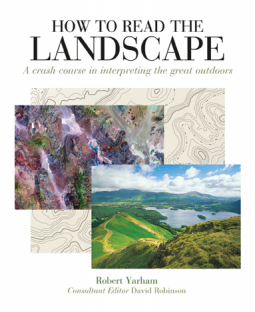
How to Read the Landscape
A crash course in interpreting the great outdoors
by Robert Yarham
This title was previously available on NetGalley and is now archived.
Send NetGalley books directly to your Kindle or Kindle app
1
To read on a Kindle or Kindle app, please add kindle@netgalley.com as an approved email address to receive files in your Amazon account. Click here for step-by-step instructions.
2
Also find your Kindle email address within your Amazon account, and enter it here.
Pub Date Apr 02 2018 | Archive Date Jun 26 2018
Quarto Publishing Group - Ivy Press | Ivy Press
Talking about this book? Use #HowToReadTheLandscape #NetGalley. More hashtag tips!
Description
How to Read the Landscape will change the way you look at the world, by presenting a visual vocabulary with which to understand the land beneath your feet. The book explains the principles of geography, geology, and geomorphology, and shows how a basic understanding of geological timescale, plate tectonics, and landforms can help you to “read” the great outdoors. It then presents a series of classic land forms and features, and uses beautiful progressive artworks to demonstrate the processes by which they were created. The reader will learn to interpret the distinctive shapes of cliffs and coastlines, mountains and hills, valleys and plateaus; to find clues to weather and water erosion; to read rock strata, minerals, and fossils; and to both use and draw maps. A primer and a field guide, How to Read the Landscape will enliven and inform your every future journey, from a hike in the countryside to a flight over the Rockies.
Available Editions
| EDITION | Other Format |
| ISBN | 9781782406020 |
| PRICE | $14.99 (USD) |
| PAGES | 256 |
Featured Reviews
April 2018
Nonfiction, nature, geology
Ivy Press
I received this digital ARC in exchange for an unbiased review from publisher and NetGalley.
A beautifully illustrated book about magnificent landscapes. The author dissects the awesome view of landscape as whole to bring attention to intricacies which make the view possible.
He begins with an explanation of the Earth’s formation and structure providing a reference point as he continues with the more complex aspects of the landscape. This book is suitable for those interested in landscapes in respect to its geological structure. The title might be a bit misleading for those who may be seeking a gardening landscape perspective.
I found the illustrations and explanations easy to understand providing a fascinating reminder of the beauty of the world around us.
 Educator 253159
I was expecting a book that was more geared toward the modern homesteader, but this was written more like a textbook. Nevertheless, the information is solid, the illustrations / pictures are helpful, and I think I will adapt this for use in a geology course for the students.
 Charity H, Reviewer
Interesting information for anyone interested in nature. It is well researched and formatted with fantastic illustrations. I like this as a book perfect when hiking to help inspire me to look more deeply in the area that surrounds me as well as appreciate it even more.
 Reviewer 446033
#HowToReadTheLandscape #NetGalley
This is a complete reference book about the geological composition of different landscapes from sinkholes to mountains. This book can be added to any library for students in geology or in civil engineering.
 Reviewer 284049
A fantastic overview of the different types of landforms and how they came to be. What really stood out to me were the photos and the graphics that really brought things together. The explanations themselves were easy to understand, but the visuals helped bring it home. This would have been a great resource to have when I was taking Earth Science back in high school.
The glossary in the back as well as the brief orienteering bits were good as well.
I would highly recommend this book to people interested in basic geology and just in general.
 Travis P, Reviewer
As an environmental science major, I was intrigued to see what this book had to offer, and let me say, it is very informative. It reads like a textbook, which I do not mind considering my schooling, but it is way more interesting then your standard textbook. The images that go along with the information really helps you grasp the material, and it has actually taught me a few things I did not know about.
 Randal W, Reviewer
Have you ever been driving along, looking at the landscape, and wonder "why is it shaped like that"? I know that I have, especially out here in the western United States. Here the ground rises and falls, leaving twisted layers of rock that look like giants must have been playing with Play-Doh to make such strange landforms.
This short little handbook explains how it happened. Faults, volcanoes, ice fields, erosion, he explains it all. And in a very simply understood manner. The great photos and diagrams really help, also.
This would be a great book to read before you take a road trip. You will be able to understand so much more of what you are seeing. And it's written in such an easy way that even a middle school child could get a lot out of it!
Reading landscapes is an extremely useful and interesting book, and helps you recognise features such as a 'Waterfall' from a 'Hanging Valley'.
This book is split into 3 parts: Understanding the Landscape, Reading the Landscape and Mapping the Landscape. Further to this, each part is then split down futher.
Part 1: Understanding the Landscape covers the earth structure and the processes that shape the earth such as volcanos and rock deformation.
Part 2: Reading the Landscape moves onto interpreting what you see be it lowland, upland, coastal or other features. Lowlands covers the hills and valleys, which include features such as mudflats and wetlands. Uplands explains the mountains and the different ways the are formed and the types. Coasts explains how our shores are created, along with features such as cliffs and arches.
Part 3: Mapping the Landscape begins by showing historical maps from 3200BCE up to modern day satellite maps. It briefly explains the differences between political, topography, geological and photographic maps before moving into more detail for the topography and geographical maps. Once you understand this and the features on a map such as footpaths and its time to head out with your local map, a compass or in the modern day, the GPS, though this navigation section only covers a few pages.
There is colour photography throughout and the features are explained also using colour drawings to further help you identify the world around you.
Overall it looks and feels like a geography study book that may suit someone doing a GCSE or A level as a quick study guide but I still found it very interesting to browse through.
I received this book from netgalley in return for a honest review.
 Ewa B, Reviewer
I received an e-copy of this book courtesy of the publisher via NetGalley.
How to Read the Landscape provides the reader with everything they need to know in order to-- well, read the landscape around them. It explains a variety of geological processes that have shaped the way landscapes look around the world, both in more mountainous regions and in the lowlands. It then goes from theoretical (although very well illustrated) explanations to showcasing particular examples of landscapes that are the results of all those processes. Sometimes it feels a little like a throwback to high school (or whenever it was you last had geography lessons), and indeed, I remember many of these pieces of information from school, but a revision was more than welcome.
While the most obvious use of the book would be to take it with you when you are travelling, I think it can also be very useful to all us writers around, especially when we are inventing our own worlds and we need to describe their geological origins. Why is there an archipelago in your world? Could the mountains even be where you have placed them? What would that river do to the landscape? Well, you can now take a look through How to Read the Landscape and figure it out for yourself.
Readers who liked this book also liked:
Jennifer Chiaverini
General Fiction (Adult), Parenting & Families, Women's Fiction
William Stixrud, PhD; Ned Johnson
Health, Mind & Body, Nonfiction (Adult), Parenting & Families

